Ha ha...indeed. Possibly strangely for holidaymakers, we're hoping it's cold.
Besides, the excellent down jacket I bought from the US has to be used.
Besides, the excellent down jacket I bought from the US has to be used.
Today was a nice sunny day again here; barefoot and t-shirt on my deck. My ancestors were vikings and Indians, like George.
First snowfall this morning. ...Big snowflakes too. ...It's white on rooftops. ...3° Canadian right now.
Ooh, by contrast I rode to the beach and swam in the Indian Ocean. Around 30C here, a little chilly in but flying over to the US tomorrow so no beach for a while. Don't think we'll have snow in NY though.
barefoot and t-shirt on my deck. My ancestors were vikings and Indians, like George.
With a name like Anderson and blonde hair, it's a safe bet there is some Swedish ancestry in my past.
We have had barefoot and shirtless weather for 9 days in a row. Last week I had my table saw set up in the driveway cutting wood for two days. Worst case temps were 20's at night 50's by day, and sunny.
That ended this morning when I went outside to be greeted with 40 F (about 4.5 C) rain. It rained all day with a high temp of 45F (7C). The TV weather guy is still saying snow tonight and tomorrow, but I see a star filled sky and a clear radar screen, so I don't know where it's going to come from.
Saturdays expected HIGH temp is 32 F (0 c). The low should be between 15 and 20 depending on which channel I watch.
The TV guy was right.....technically.
There are patches of snow on the ground and the top of my blue car is still white at 10 AM. There are still a few flakes falling every few minutes from a grey and overcast sky. Temp is 31F.
There are patches of snow on the ground and the top of my blue car is still white at 10 AM. There are still a few flakes falling every few minutes from a grey and overcast sky. Temp is 31F.
so, nothing strange about this late fall, winter then?
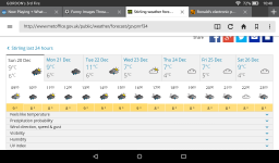
New York, New York 14 Day Weather Forecast - The Weather Network
New York, New York 14 Day Weather Forecast - The Weather Network
We were out shopping most of today in Ohio, West Virginia, and Pennsylvania. Yes, it sounds like a big trip, but total distance travelled was less than 50 miles, all on or near I-70. We were greeted with freezing temperatures and snow in all 3 states. It was snowing pretty hard at our last stop, the grocery store. We got home at about 6:30 PM, then the real fun started. I couldn't see the car from the house window about 10 feet away...it IS a white car. I looked at my iPad for the local weather to find this:
Special Weather Statement for Marshall County, WV (where we live)
... A SNOW SQUALL WILL AFFECT MOST OF WESTERN PENNSYLVANIA... NORTHERN WEST VIRGINIA... AND PORTIONS OF EASTERN OHIO...
AT 708 PM EST... A LINE OF INTENSE SNOW SQUALLS WAS ALONG A LINE EXTENDING FROM NEAR FRANKLIN PENNSYLVANIA TO JUST WEST OF NEW MARTINSVILLE WEST VIRGINIA. MOVEMENT WAS EAST AT 20 MPH....
....THIS INCLUDES THE FOLLOWING HIGHWAYS......... INTERSTATE 70 IN OHIO BETWEEN MILE MARKERS 199 AND 225. INTERSTATE 70 IN WEST VIRGINIA. INTERSTATE 70 IN PENNSYLVANIA BETWEEN MILE MARKERS 0 AND 57.
VISIBILITIES WILL LOCALLY DROP QUICKLY TO LESS THAN A QUARTER OF A MILE IN THIS SQUALL... AND ROADS WILL RAPIDLY BECOME ICY.
USE EXTRA CAUTION IF YOU MUST TRAVEL INTO OR THROUGH THIS DANGEROUS SNOW SQUALL. RAPID CHANGES IN VISIBILITY AND POTENTIALLY SLICK ROADS ARE LIKELY TO LEAD TO ACCIDENTS. CONSIDER DELAYING TRAVEL UNTIL THE SQUALL PASSES YOUR LOCATION.
The major snow squall has passed over our area leaving about 1 inch of accumulated snow in about half an hour. A light snow continues to fall. The current temp is 27F and falling, so it will still be here tomorrow morning.
The radar shows the squall currently in the Pittsburgh area. The futurecast radar shows the snow dissipating long before it reaches the NYC area, but.......
Member
Joined 2009
Paid Member
but today I saw a snow flake
Radar shows a few more coming your way, in fact some should be there about.....uh, now (9:45 PM EST) maybe a bit more overnight.
Water is still liquid in my neck of the woods, and we're supposedly going to get some from the skies tonight/tomorrow. I haven't seen sea level snow since I moved out here to Cali 35 years ago. I have seen some of the surrounding peaks get a load, though.
We had a freakish spell of warm weather here in the UK. Up to 14°C ( 58°F ) but it will drop again next week, might even snow for Christmas day.
Went out to the ice rink that's at the top of the hill at about 11AM. I could have used my ice skates on the roads at the bottom of the hill (East Cleveland). An inch & a 1/2 of snow turned to a great skating rink, but other drivers didn't think so.
There was about an inch of snow on my wood deck this morning, a bit less on the ground. The sun came out and melted most of the snow creating some large pools of water. Those are now frozen over and likely will become completely solid over night since it is already 30F with an expected low of 24.
Warmer weather mid week will make it all go away. Last year the snow - melt - refreeze cycle went on for about 2 weeks in late January.
Warmer weather mid week will make it all go away. Last year the snow - melt - refreeze cycle went on for about 2 weeks in late January.
Member
Joined 2009
Paid Member
Went out to the ice rink that's at the top of the hill at about 11AM. I could have used my ice skates on the roads at the bottom of the hill (East Cleveland). An inch & a 1/2 of snow turned to a great skating rink, but other drivers didn't think so.
Ever go to the Skating Club just north of Shaker Square?
Be vigilant - those are the kind of conditions(melt/refreeze) that open up leaks in roofs.
I agree, but what the heck do I know? 🙂
but it will drop again next week, might even snow for Christmas day.
Seem's like I spoke too soon. It's going to be 11°C ( 52°F ) on Tuesday and 7°C ( 45°F ) on Christmas day, not much chance of snow then!
Attachments
- Home
- Member Areas
- The Lounge
- The Weather